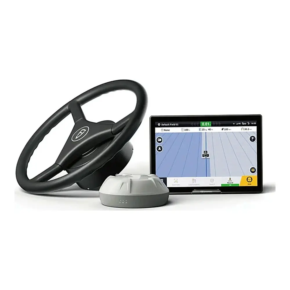
AL02 3D Land Levelling System
Buy the FJD AL02 3D land levelling system with GNSS and RTK: survey, design and level fields for better drainage, water management and higher yields.
- Product Category : Shop all Autosteer Systems
- Price Range : €6,274
- Availability : In stock · ships from Frankfurt (Oder), Germany
- Shipping : Europe and worldwide – see our shipping policy · 30-day returns
- Select Varient :
Features
Explore Product Features
GNSS-Based System
Terrain Digitalization
Terrain Survey & Design
Terrain File Transfer
Height Calibration
Record Reserve
FJD 3D Land Levelling System (AL01 / AL02): GNSS Field Levelling from Survey to Finished Surface
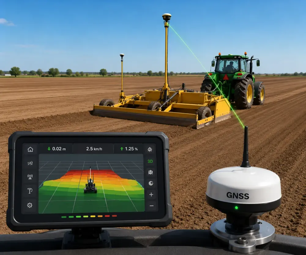
The FJD 3D Land Levelling System uses GNSS and RTK positioning to survey a field, design the ideal surface and then control the tractor's levelling blade automatically until that surface is reached. It is built for farmers, contractors and land-improvement businesses who need flat or precisely sloped fields for irrigation, drainage and even crop establishment. Covering the FJD AL01 and its successor the FJD AL02, this land levelling system for sale replaces guesswork and repeated passes with a planned, measurable workflow.
Uneven ground leads to standing water in some places and dry patches in others. A properly levelled field lets water spread evenly, which supports more uniform germination and growth. If you want to buy FJD land levelling equipment, this page explains what the system does and how it fits into your operation.
Key Features and Benefits
Integrated survey, design and levelling workflow
Terrain survey, surface design and blade control are linked in one process, so the data you collect in the field feeds directly into the plan the tractor follows.
Terrain survey
Elevation data is gathered by driving the field boundary and collecting interior points. Master and secondary benchmarks are set first, and height calibration keeps readings consistent.
Flexible surface design
Design a level surface, a single slope or a double slope to match your field and water management plan. The AL01 software also provides cut-and-fill and earthwork analysis and lets you set the direction of water flow.
Automatic blade control
During levelling, the system raises and lowers the blade automatically to follow the target surface, so the operator can concentrate on driving.
File transfer and multi-machine work
Survey and design files can be imported and exported between supported equipment and project stages. With the AL02 Max, several equipped tractors can share project files and work to the same levelling plan.
Project records and reports
Completed jobs are saved, previous records can be reused, and the AL02 can generate PDF reports for documentation.
How the System Works
A GNSS receiver on the tractor, supported by RTK corrections from a base station or CORS network, measures the machine's position and height. First the field is surveyed to build a digital terrain model. Next, the operator designs the target surface on the terminal. Finally, the blade control unit, which FJD describes as controlling blade lift and tilt and the extension of the retaining board, moves the blade hydraulically so that soil is cut from high spots and deposited in low spots until the design surface is achieved.
For the AL01, FJD states a positioning accuracy of 2.5 cm (varying with conditions) and a light-load mode with a maximum speed of 15 km/h. According to FJD, AL01 users can achieve around 40% higher work efficiency and roughly 10% lower fuel use in light-load mode, and levelled fields have shown up to 22% water savings compared with unlevelled land. Your own results will depend on soil, terrain and machinery.
Applications: Who Should Use It?
- Rice and paddy growers who need even water depth across the field.
- Irrigated arable and vegetable farms using furrow or flood irrigation.
- Farms with drainage problems that benefit from a planned single or double slope.
- Contractors and land-improvement firms offering precision levelling as a service.
Technical Specifications
| Feature | Specification (as stated by FJD) |
|---|---|
| Positioning | GNSS with RTK corrections |
| Accuracy (AL01) | 2.5 cm, varies with conditions |
| Light-load mode maximum speed (AL01) | 15 km/h |
| Surface designs | Level, single slope, double slope |
| Blade control | Automatic height control; lift, tilt and retaining-board control via VCU |
| Records | Project history; PDF reports (AL02) |
Machine compatibility and functions depend on the configuration. FJD lists the AL01 as discontinued, with the AL02 as the current generation, so please contact us to confirm which version is available for your order.
What You Need and Related FJD Products
The system works with a tractor and a hydraulically controlled levelling blade. For RTK corrections, FJD offers the FJD V1 base station, a portable unit with a working range of about 5 km, the FJD N20 GNSS station with a range of up to 30 km, and the FJD Trion N10 CORS system. Our team can help you choose the correction source that best suits the size and layout of your fields.
Compare more precision guidance and levelling systems, or read RTK vs GPS for agriculture before you choose.
Why Buy the FJD Land Levelling System from CMC SmartFarm
CMC SmartFarm sells FJD precision farming equipment throughout Europe and worldwide, with prices shown in euros. We offer advice before you buy, helping you choose the right model and correction source for your blade and tractor. To get the FJD AL02 price delivered to your country, send a quote request through our contact page.
Buy the FJD AL02 Land Levelling System Online: Price Quotation, Wholesale and Delivery
You can buy the FJD AL02 Land Levelling System online at CMC SmartFarm and order it directly from this page, or request a price quotation for your exact configuration through our contact page. The system is made by the manufacturer FJDynamics, and CMC SmartFarm acts as your supplier of FJD precision farming equipment from Germany.
We work with commercial customers as well as individual farmers. Agricultural contractors, farm groups, machinery dealers and resellers can ask for a wholesale price on a bulk order for a whole fleet of tractors, and every B2B quotation includes delivery costs to your country. We arrange delivery and shipping across Germany, the European Union and worldwide, so the FJD AL02 Land Levelling System can reach your farm wherever you work.
FAQ
What is the difference between laser and 3D GNSS levelling?
GNSS levelling works from satellite positioning and a digital field design, so it supports surveys, slope designs and records without relying on a laser transmitter.
Do I need an RTK base station?
Yes, RTK corrections are needed for centimetre-level work. You can use an FJD base station or a CORS network.
Can several tractors level the same field?
With the AL02 Max, equipped tractors can share project files and work from one plan.
Which version will I receive?
Contact us before ordering to confirm whether the AL01 or AL02 is available.